Siksika Nation
Land Management
Siksika Nation Land Management is the day-today management and administration of reserve lands, environment, and resources. It generally includes activities related to the benefit of use and development of land for individual, collective and economic purposes.
CONTACT US
- P.O. Box 1580 Siksika, AB T0J 3W0
- (403) 734-5282
- Toll Free: 1 800 551-5724
ABOUT
Siksika Land Management is responsible to manage and protect the health and diversity of the land base for the use and enjoyment of present and future Siksika members. This view differs from mainstream society view on the importance of land, for it is difficult if not impossible to emphasize the importance of land to Siksika people because it is the source of self – identifications. LMSA strives to balance the development of reserve lands and natural resources for economic development purpose as well as meet the social demands for the general betterment, protection, and/or conservation needs of Siksika.
Siksika receives funding from Indigenous Service Canada under the ‘Reserve Land and Environment Management Program’ (RLEMP). The funding provides monitoring, compliance and building capacity to develop, manage and exercise increased responsibility over these lands, resources, and environment under the federal legislation of the Indian Act. Currently Siksika is under the operational stage of this program which entails involvement in a broader spectrum of activities pursuant to the Indian Act and/or Siksika First Nation priorities.
These include but are not limited to the following:
- Development, Implementation, Compliance and Monitoring of Land Use Planning, and related Policies and Regulations.
- Overall management of Siksika Reserve Lands which includes accepting, processing and preparation of land use application or access requests for Band Council and/or ISC’s approval.
- Development of Environmental Management Protection Plan.
- In collaboration with Natural Resource Canada complete Land Surveying and occasional boundary line investigation.
- Ensure compliance of contractual land, natural resource agreements, permits and other land approval instruments to applicable Federal, or Siksika’s Legislation policies, procedural or bylaws.
- Provide Technical support with Additions to Reserve (ATR) or other land – natural resource related matters.
- Water Source Protection, Water Resiliency, Climate Change.
- In collaboration with Indian Oil and Gas Canada (IOGC) and Alberta Energy Resource (AER) manage and monitor Oil and Gas activity including Site Reclamation and Abandonment efforts.
COMMUNITY VISION
To ensure Responsible Planning, Management, and Sustainability of Siksika Lands, Cultural and Significant Sites, Environment, and Natural Resource
COMMUNITY MISSION
Siksika Nation, through quality leadership, will maintain growth through our ancestral wisdom, traditions, and beliefs. This inspires the community to building a healthy, vibrant, and safe environment through strong leadership and rooted in Siksikawa wisdom and traditions.
COMMUNITY VALUE STATEMENT
Siksikawa Iitomaitakiiyaw Niipaitapiiwahsin Ki Niitaistawatsimoap
We are charged by the Creator with the duty of preserving and protecting the land for future generations.
The Siksika Community Value Statement seeks to invigorate and affirm the sacred duty of land stewardship for sustainable and healthy future generations.
Land Use Plan
The Land Use Plan (LUP) serves as a comprehensive guiding the management of land for community initiatives such as housing, utilities, and economic development. More importantly, it’s a living document, which means it can be revisited and revised to meet the evolving needs of the community. Acting as a roadmap for decision making and development on reserve lands, it is owned by the community and reflects the culture and values of Siksika.
STAFF LIST
project communications coordinator/Acting L&P Coordinator
Land Management
WHAT WE DO
LMSA (Land Management Service Area) is currently structured to deliver Environmental and Field, Land & Policy Administration, and Special Land Projects services. In consultation with appropriate legislative or regulatory agencies LMSA ensures proper and accurate land and natural resource surface, and sub-surface authorization and documentation occurs. LMSA assists and provides technical support in the implementation, monitoring, review and updating of nation lands, resources, water, environment, and special projects related activities on reserve.
LMSA ADMINISTRATION
FIELD AND ENVIRONMENT UNIT
Siksika Land Management Field and Environment is responsible for optimal service delivery of the assessment, management and compliance of land, environment, and resource related activities. They provide strategic direction and leadership for compliance and environmental management for the betterment and preservation of Siksika Lands, Water and Resources.
Our Services
- Multi-Year Fencing Replacement and/or Repair Program- For reserve boundary lines, communal pastures, Provincial right of ways, and occasionally CP railway fence lines.
- Field Reconnaissance and Data Gathering for any incoming land use applications or upcoming projects.
- Assist in implementation of Land related special projects.
- Monitor and Compliance on various Land related and Environmental issues.
- Perform specific field technical land surveillance and data gathering. Utilising GIS platform
- On-going monitoring and compliance of Oil & Gas operations on Nation land. With the guidance of Federal and Provincial Agencies (IOGC) also AER.
ENVIRONMENT & FIELD DEPARTMENT
Darren Many Heads- Environment and Field Coordinator
“Oki, I have worked with Siksika Land Management for over 36 years. I have an extensive background in working in the field and Director of Natural Resources.”
Lance Breaker- Field Technician
“Oki, I have worked with Siksika Land Management since November 2016. I oversee the maintenance and planning for our fencing projects. I also do the field encumbrance and data gathering for any upcoming land use applications or projects. This past summer we started our Land Use Inventory process to gather information on all band level users of land in relation to agriculture, livestock, and commercial ventures. We will be continuing to gather more information on the various uses identified and hope to have some future workshops or information sessions regarding this soon.
Kaley Wahpenahwasis- Environment Field Technician
“Oki! I have been working in the environmental field for the last 7 years. Prior to working for Siksika, I worked for my nation as an off-reserve Environmental Monitor for our Duty to Consult department. My main job here at Siksika Land Management entails conducting environmental site assessments for on-reserve proposed projects as well as assisting in anywhere else I am needed.
Shawn Red Crow – Field Technician: Shawn has worked for Siksika Land Management seasonally as a monitor, Liaison and Field Technician.
LAND AND POLICY ADMINISTRATION UNIT
Land & Policy Administration (LPA) under the direction of the Land Manager, ensures proper and accurate land and natural resource authorization and documentation occur. LPA ensures that land uses are in accordance with relates legislation and the sections under the Indian Act that pertain to Land.
LPA works with the Nation to ensure proper land tenures are executed and properly registered in the Indian Land Registry System. Some Land Tenure, also known as Land Instruments, are as follow:
- Industrial Park Land Designation- Commercial Lease
- Blackfoot Crossing Historical Park -Commercial Lease
- 28(2) Agriculture Permits
- Siksika Irrigated Lands Corporation- Agricultural Headlease
- Utility Permits (Bell, TELUS, ATCO)
- General Access / Oil & Gas Permits
Carolyn Turning Robe – Land & Policy Coordinator “Oki, I have worked with Siksika Land Management since 2014. I completed my National Certification as a Lands Manager with NALMA (National Aboriginal Land Managers Association) in March 2022. I enjoy working with LMSA it gives me an opportunity to understand the land and its role in our way of life”.
Betty Many Shots – File Clerk “Oki, I have Just recently started with Siksika Land Management, Currently I am a Registered File Clerk. I have Graduated In 2017 From Strathmore High School. I have a certificate in
the Human Service Field. I have recently been given the opportunity to go for some courses in Record management to help me better understand my position as a file clerk.”
Dallas Bear Chief – Land Clerk “Oki, I have been working with Siksika Land Management for a brief time now. I assist in preparing agreements and document files for land and natural resource related requests and activity. I am responsible for the issuance, reconciliation and reporting of general access permits, surface, and subsurface leases, permits and other related fee schedule payments. I also assist in desktop reviews of land and natural resource related surface and subsurface agreements and files.”
Brent Spring Chief – Land Administrator “Hi, I have worked for Energy Safety Canada for the last 8 years prior to my employment with Siksika Land Management in 2022. I am a certified Land Administrator and in Health & Safety Certification. After gaining experience off reserve, my goal was to come back and work for the Nation and bring my experiences.”
Land and Policy Administration- Permit Request Service
Contact Permit Clerk to request an Oil & Gas Permit or General Access Permit form.
SPECIAL LAND PROJECTS UNIT
Dale Spring Chief – Special Lands Project Coordinator
“Oki, I have returned to Land Management after a lengthy time, and fortunate to gain experience off reserve, working with Industry and other First Nations and at home working with other departments and entities. My background is Project Management, Business Administration and Accounting. I am glad to be back here at Lands, I truly enjoy working for my Nation with our elders and knowledge keepers on what matters most regarding our Lands.”
SIKSIKA SHELTERBELT PROGRAM
Siksika Nation in partnership with Project Forest have initiated a Shelterbelt Program, which is designed to harness the power of shelterbelts—a proven Nature-based Solution—to mitigate the impacts of climate change, sequester carbon, and take meaningful steps towards equitably distributing trees, and their associated ecosystem services, to the people living on Siksika Nation.
Increasingly, residents of Siksika Nation are experiencing the harsh effects of climate change, with little to no protection from extreme weather. The shelterbelts will provide the community with long-term environmental resilience to the effects of climate change, including mitigating extreme wind, trapping moisture, regulating temperatures, reducing the loss of topsoil, cleaning the air and water, creating habitat for wildlife, decreasing noise, and increasing privacy from passing highway traffic, and providing spaces for traditional land-use activities like berry- and medicine-picking.
Project Forest and Siksika Nation, in consultation with Siksika Land Management Elders Advisory Panel, worked together to create a list of trees and plants that will both perform well in Siksika Nation’s challenging growing environment and provide the community with species that are culturally significant. In line with the Nation’s desire to meet their sustainability goals, the species being planted are highly productive and able to sequester substantial amounts of carbon, providing the Nation with the economic opportunity to engage in future carbon markets.
North camp Area – Phase 1, Part 1 – Community Shelterbelt in yellow Phase 1, Part 2 – Agricultural Shelterbelt in orange

SIKSIKA EMAP ROAD NAMING PROJECT
In early 2021, Siksika Nation, in partnership with ATCO Ltd, planned and delivered a Road Naming Project to extend the services of the Siksika Nation Emergency Management 911 Mapping Project.
911 services on Siksika Nation would enable the Administration, Emergency Services and their regional partners on their emergency response, evacuation, and communication abilities.
The project included existing data review and GIS mapping of paper road maps, addition of road names, the delivery of a Road Naming Policy workshop and an in-kind proposal development and submission for the procurement of road signs and installation.
- Phase 1 (Jan 2021): Reviewed existing data, 1st draft of policy completed.
- Phase 2 (Dec 2021): Ground review completed with Roads Department.
- Phase 3 (Spring 2022): Data entry, Community awareness.
- Phase 4 (Dec 2021): Proposal development.
- Phase 5 (March 2022): Project Close for ATCO Ltd – transferred to Siksika Land Management.
- Phase 6 (May 2023): QGIS Mapping to sequence working group and Elder Advisory Panel consultation on naming of roads in English and Blackfoot, purchasing of signs, and finalizing of policy.
- Phase 7(Jan 2024): We are here now. All road names have been finalized. Land Management Advisory Panel expanded scope of project to include naming and/or renaming of Communities within Siksika, which has also been finalized. Working group review of names and policy with Public Works, Housing, Public Safety, and any other applicable departments will occur 1st quarter in 2024.

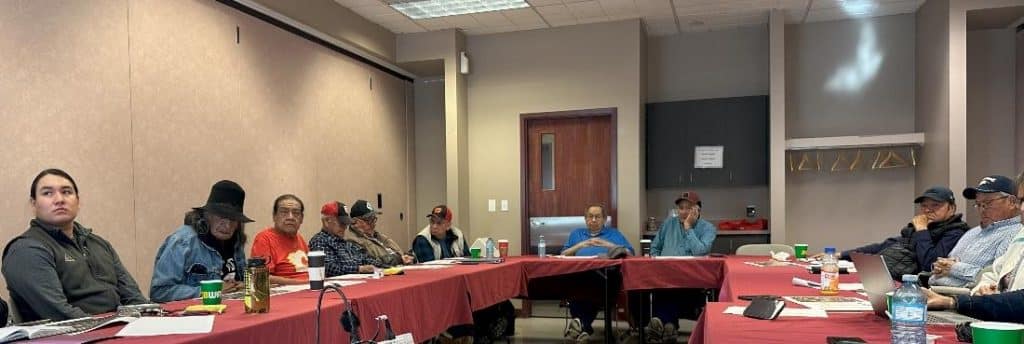
LAND MANAGEMENT ELDER ADVISORY PANEL
In the Spring of 2023, it was determined that with LMSA vision to proceed with the drafting of the Land Use Plan and in guidance with other projects that an advisory panel would need to be created. Initially, we only had elders, however in a brief time and with the recommendation from the elders, this group expanded to include Traditional Knowledge Keeper(s) and Youth representative(s). As of February 2024, this group consists of 13 elders, 1 Traditional Knowledge Keeper and 1 Youth representative to guide and assist LMSA.
SIKSIKA INDIAN RESERVE QUICK FACTS
- Formed 1877—Treaty #7. Siksika is considered the second largest reserve land base in Canada.
- Reserve total area 210,080 acres or 328.25 sections. Each section contains approx. 640 acres of land and is about 1 sq mile in size.
- Located within Township 20 to 24 and between Range 19 to 24.
Approx 115 miles of reserve boundary established. - Approx 36% of land base taken up by 30 Communal Pastures (74,122 acres or 116 sections).
- Approx 23% taken up by agricultural fields that are either leased, and/or permitted or occupied by Siksika members. (47,760 acres or 74.6 sections).
- Cultivated Soil rated Class 2, 3 & 4.
- Approx 88,198 acres is occupied by residential communities or individuals’ homes; public space & facilities; commercial or small business operations; recreational acres & pathways, natural undisturbed areas/regions, and significant/sacred sites.
- Within a six (6) decades period starting in 1966, Land Management has grown and evolved to handle operational land management functions for both Indian Act and internal Siksika land use purposes.
- Land Inventory Project (2023) confirms collection of land uses such as Agricultural, Livestock, Communal Pasture Grazing, and Small Business.
- The 1910 Surrender Claim was recently settled and consists of 115,000 acres of Siksika Reserve land and certain mineral rights taken by Canada. Under the settlement, Siksika has the opportunity to acquire additional acres of land overt time; for addition to reserve (ATR) opportunities of which LMSA provides technical support to Band Council and related parties.
- After completing community engagement and technical land planning work, Siksika Nation Ohkinniinaa (Chief) and Ninaaks (Council) officially approved the 20-year Land Use Plan (LUP) document on January 24, 2024. LUP is a living document subject to periodic updates as determined by LMSA.
- LMSA is now moving into LUP Phase Three – Implementation, Monitoring & Evaluation which will take a few years to fully complete.
- LMSA commissioned updated to the 2011 Water Needs Assessment Report in anticipation of growing concern with sustainability and security of future water supply of Siksika.